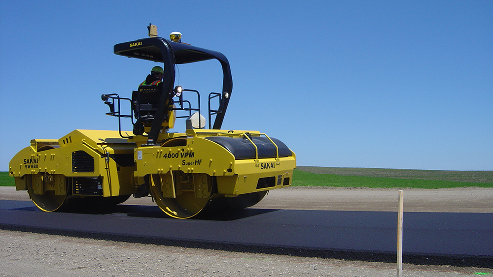
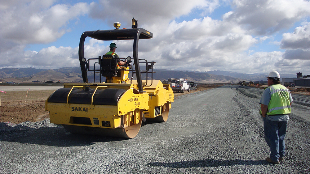
Adequate and uniform compaction of road materials, such as soils, aggregate bases, and asphalt pavement materials, is one of the most important requirements in roadway construction. It is indispensable to strive for high quality of compaction to ensure long-lasting performance. Intelligent Compaction (IC), which uses modern vibratory rollers equipped with an integrated measurement system, an onboard computer reporting system, Global Positioning System (GPS) based mapping, and optional feedback control, helps improve compaction quality control.
“Intelligent Compaction provides crews with continuous compaction control with real-time monitoring,” said Dr. George Chang, Director of Research at The Transtec Group. “IC can help the roller operator better control and achieve the coverage for compaction, which is very difficult to do without guidance.”
Now that construction season is well underway in the United States, the Federal Highway Administration (FHWA) and pavement engineering firm The Transtec Group published two intelligent compaction technical briefs to help construction teams and organizations effectively and efficiently implement IC.
Specification for Intelligent Compaction
The Specification for Intelligent Compaction Technical Brief (FHWA-HIF-17-037) provides a review of national and state IC specifications and recommendations for future enhancements. The FHWA and AASHTO have developed national IC guide specifications and an increasing number of state agencies have also developed their own IC specifications. There is a lot of variance, however, among the contents of state IC specifications.
“Without requiring IC in construction specifications, it is very difficult to make IC widespread,” said Dr. Chang. “The goal of the tech brief is to make complicated technical content more palatable to the public so they can digest the material in a short-form publication.”
Common elements of IC specifications include IC system requirements, a quality control plan, training, field operation requirements, data requirements and submission, and measures and payment. This tech brief provides guidance for state DOTs to customize those elements into their specification.
Color-Coded IC Maps
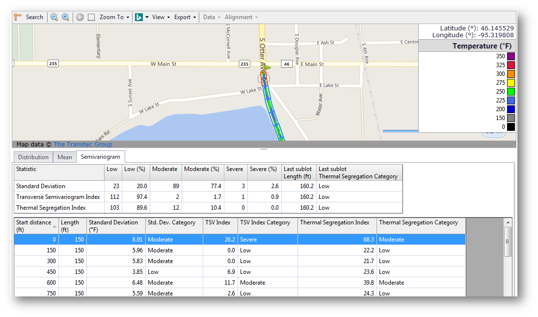
The Color-Coded IC Maps Technical Brief (FHWA-HIF-17-036) outlines guidelines and recommendations for color-coded maps using IC and paver-mounted thermal profiler (PMTP) data. These maps include items such as roller passes, asphalt surface temperatures, and stiffness values.
IC and PMTP systems have been gaining popularity across the US over the past decade to improve compaction quality and detect temperature segregation behind pavers. On IC and PMTP systems, color-coded maps from their onboard displays are used extensively for monitoring and visual inspection of collected field data and machine operation.
“Visual inspection in the field is one of the very first steps for quality and acceptance of construction, such as meeting required roller passes and coverage and minimum asphalt temperatures” said Dr. Chang. “Using a consistent color palette will make inspections consistent and the process robust.”
Veta Software
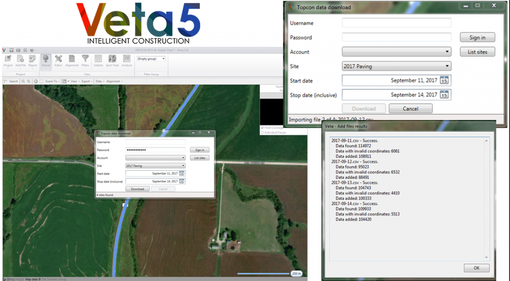
IC and PMTP systems gather a tremendous amount of complex geospatial data that poses challenges for data management, analysis, and reporting. These issues have become the main hurdles during implementation. To address the above issues, the Minnesota Department of Transportation, FHWA, and the Transportation Pooled Fund Study, TPF-5(334) have funded development of the Veta software tool for IC and PMTP data viewing and analysis.
Veta is a map-based software tool for viewing and analyzing geospatial data. Currently, Veta can import data from various IC machines and PMTP scanners to perform editing, filtering, spot test correlation, and statistical analysis as a post-processing tool.
One of the salient features of Veta is viewing IC and PMTP data as color-coded maps on top of geographical road or aerial maps to facilitate quantitative interpretation. Key examples are for evaluating consistency of rolling patterns and for identifying cold blobs or streaks of asphalt temperature segregation. Veta allows users to select any specific passes to be viewed, including the last pass or final coverage.
Veta is required in FHWA and AASHTO PP80-17 specifications, and is increasingly adopted by state highway agencies.
The Transtec Group developed Veta with support from the FHWA. Veta is free to download. Currently, the Transportation Pooled Fund (TPF) study, “TPF-5(334) Enhancement to the Intelligent Construction Data Management System (Veta) and Implementation” is leading the effort for enhancing and maintaining Veta to facilitate the national IC/PMTP implementation.